I had already postponed a run this week with my Sheila, a long-time trail running friend. So, as I tossed and turned past midnight, with the alarm set for 4:45 AM, I decided I was just gonna have to buck it up if I wanted to get out for an early morning run on the 4th of July. I needed a run with a friend. And I needed a run in the mountains. That only way that was going to happen was to go out with the dawn patrol.
And so, fireworks and firecrackers rang out through the night as I attempted to get even a few winks of sleep. I recall waking at 2:00 AM, again at 3:00 and my God, once again at 4:00 when I told myself that I still had forty-five minutes to gain a wink. (And I do believe that I slept most of that time.)
When 4:45 AM rolled on in on the great U.S. holiday, the 4th of July, I was out of bed, slowly but surely getting dressed. I pushed the button on my two-cup coffee maker and packed my vest. I brought along about 60 fluid ounces of water (mixed with Nuun), a hat, sunglasses, a red bandana, my garmin, an Ipod which I probably would not use (but I never leave home without), a knife, my phone, lip balm, toilet paper (which I probably would use), ibuprofen, a camera (which I would definitely use), and believe it or not, a jacket on this 4th of July – oh, and I believe my driver’s license was still tucked deep in my pack from my last run (and I think it’s still there).
The fog was thick as I drove through Rancho Santa Margarita and even thicker along Santiago Canyon Road. I attempted to answer a call from Sheila several times, mostly with no response, a couple of times I could hear her voice, but she could not hear mine. I worried that she had perhaps cancelled, so I decided that as sleepy as I was, I’d go ahead and run anyway if that was the case.
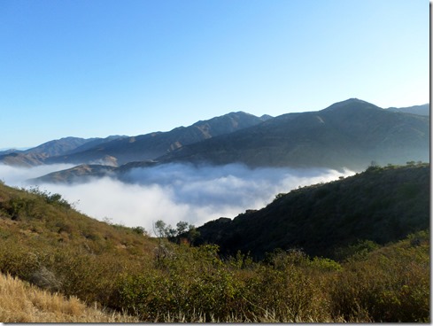
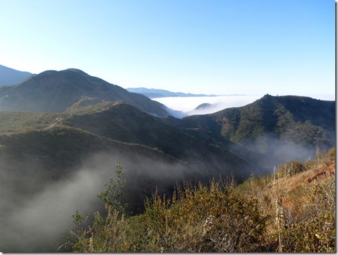
Eventually, we met up at the corner of Modjeska Canyon Road and Santiago Canyon Road and she followed me as we drove the windy road up to Modjeska Grade were we found a spot to park. We took that asphalt, uphill road for about a half a mile before reaching the trailhead to Santiago Truck Trail. The weather was cool, almost cold, the clouds thick and air misty. The moon was still high in the sky as we climbed up above the low clouds. We didn’t see another soul as we set off ascending that popular, yet remote trail named Santiago Truck Trail. Within a half mile (I’m guessing), we stopped to take off our jackets and tied them around our waists.
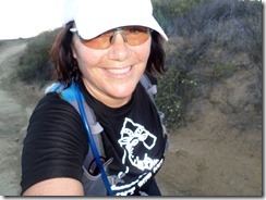 There’s quite a bit of uphill climbing along Santiago Truck Trail – hiking kind of climbing for me during parts of it. But there’s also some rolling hills, and with the cool weather and low-lying clouds, the climbs were very bearable. I lost my red bandana along the way, but didn’t fret, as I was certain that I’d find it on the return trip. (I of course did not find the bandana, but was satisfied that in my mind, someone else had found it, and that it would come to good use in their travels. I was happy in the fact that I could pass on something that I had held for many years.)
As I mentioned earlier, the trails were empty when we first set foot on them. I’m not certain when we saw our first travelers, but I am certain they were cycling. All the travelers that we eventually came upon (and there were many) rode a bike. Except for one: there was a gentleman, wearing a vest pack like Sheila and I. We met him on the return, on an uphill as he was traversing down. He was fresh and smiling. We smiled too, but fresh . . . not so much.
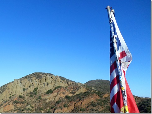
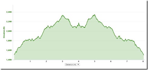
But I digress, and have gotten ahead of myself. We ran out to a flag, which flies across from the vulture crags. It’s also the location where the top of The Luge, a popular bike trail, meets. I had hoped that the flag measured the 5 mile mark, but recalled from earlier runs, that it would measure short. Ends up, it was just shy of 4 miles. So, after signing the registry there, we took off further to make the “out” portion measure precisely 4 miles before turning back on the trail toward our cars.
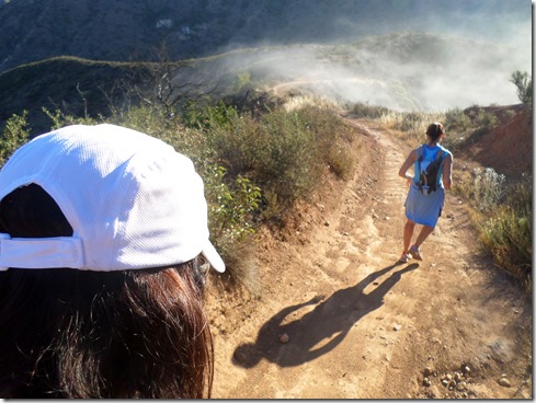
I noticed more than one bunny cross our path. And though I saw no snakes, I spotted their trails here and there. With Sheila running out ahead, and about two miles remaining in our trip, I got to witness a tiny rockslide not too far from my feet as a spray of dirt spit forward from my left and a small boulder tumbled down and shot out onto the trail.
Fossil Rock with about a mile to our cars:
With only 8 miles covered on Saturday’s lovely run, I wasted my feet. Wasted. Particularly the left foot which throbbed pain from its arch for the remainder of the day. My family and others in the neighborhood walked to a nearby bluff where we watched fireworks shot off from the marina. I suffered pain on the walk there and back. My relief was immense when my husband taped my arches later that night.
That’s just the way it is right now. I’ll take it.
No comments:
Post a Comment